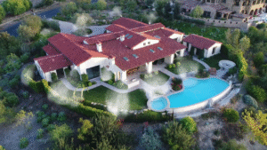
Wildfire risk is the likelihood that your home could be exposed to wildfire conditions and suffer damage or loss.
That risk is influenced by two major categories:
- Exposure risk
- Structure survivability
Exposure means how likely fire is to reach your area. Survivability means how likely your home is to resist ignition if it does.
This is an important distinction because two homes in the same neighborhood can have very different outcomes during the same wildfire event.
Understanding wildfire risk is no longer optional in California. It now affects safety, insurance availability, property value, and long term ownership costs.
Editor’s note: Your insurance situation depends heavily on your property’s actual fire exposure. Our free risk assessment factors in official CAL FIRE data to show what your risk level actually is — useful context before talking to your carrier.
Why Some Homes Are More Vulnerable Than Others
Many homeowners assume wildfire risk is only about location.
Location matters, but it is only one part of the equation.
Homes become more vulnerable due to:
- Dense vegetation near structures
- Combustible materials within Zone 0
- Wood fencing attached to the home
- Older vents vulnerable to embers
- Roof debris accumulation
- Poor defensible space maintenance
- Steep slopes below the structure
- Wind exposure corridors
A home in a moderate zone with poor preparation may face more danger than a hardened home in a higher risk zone.
Not sure which step to prioritize first? Our wildfire risk calculator shows your CAL FIRE zone and exposure level — so you know exactly where to start.
Fire Hazard Severity Zones Explained
California uses Fire Hazard Severity Zones, often called FHSZ maps, to classify wildfire exposure.
These zones generally include:
- Moderate
- High
- Very High
They are based on factors such as:
- Historical fire behavior
- Fuel loads
- Terrain
- Wind patterns
- Ember potential
These maps are useful, but they do not tell the full story. They show regional hazard, not property level preparedness.
Wondering if your property is in a high-risk fire zone? Check your wildfire risk score to see your CAL FIRE zone and exposure level based on your address.
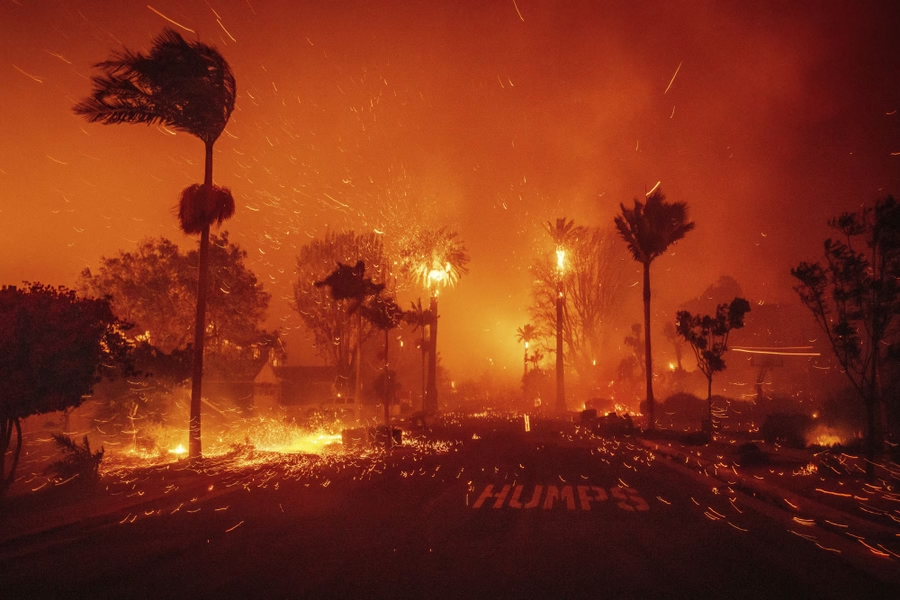
What the WUI Means for Homeowners
WUI stands for Wildland Urban Interface. This is where homes and development meet undeveloped vegetation or wildland fuels.
Many California communities fall into the WUI, especially:
- Canyon communities
- Foothill neighborhoods
- Mountain towns
- Edge of city developments
- Rural subdivisions
Living in the WUI often means elevated wildfire risk because structures are closer to available fuels and ember pathways.
For insurers, WUI location is often a major underwriting factor.
How Vegetation Impacts Wildfire Risk
Vegetation is one of the most controllable wildfire risk factors.
What grows around your home matters.
High risk conditions include:
- Dense shrubs near walls
- Overhanging tree limbs
- Dry grasses
- Continuous hedge lines
- Mulch touching structures
- Dead vegetation buildup
Lower risk conditions include:
- Maintained defensible space
- Proper plant spacing
- Irrigated and healthy landscaping
- Non-combustible Zone 0 surfaces
- Reduced fuel continuity
This is why defensible space remains one of the smartest investments a homeowner can make.
Why Topography and Slope Matter
Fire moves uphill faster than many people realize.
Homes located above steep slopes often face greater wildfire risk because flames and heat preheat fuels upslope.
Higher concern locations include:
- Homes above canyons
- Structures mid slope
- Properties at ridge saddles
- Chimney shaped drainages
- Narrow ravines
Even a beautiful view lot may carry hidden wildfire exposure.
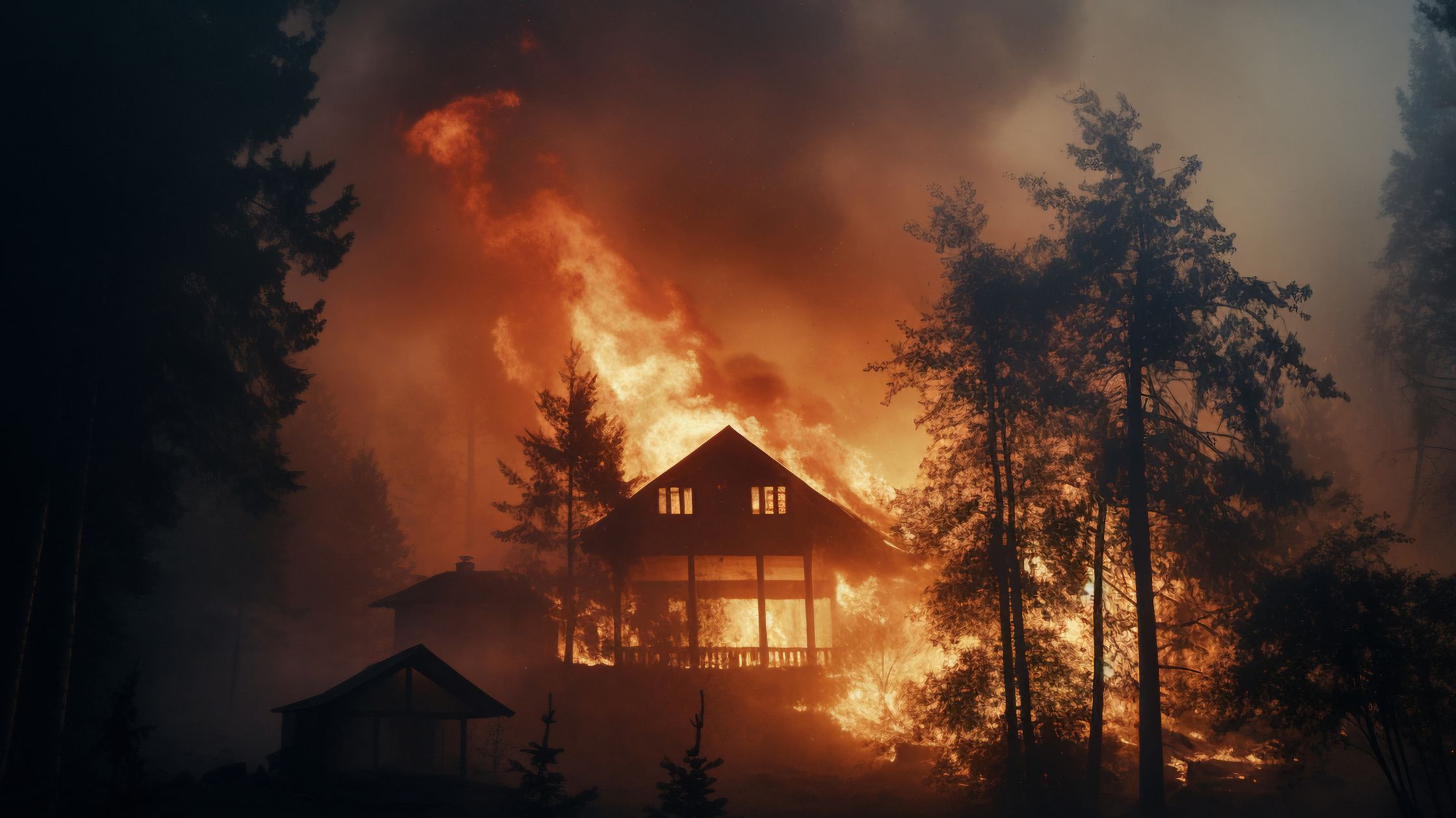
Wind and Ember Exposure
Many homes do not burn from direct flame front contact. They ignite from embers.
Wind can carry burning embers miles ahead of the main fire and deposit them into vulnerable areas such as:
- Roof valleys
- Gutters
- Deck corners
- Attic vents
- Fencing connections
- Dry landscaping beds
This is why home hardening and ember resistant retrofits are increasingly critical.
A house can appear safe from flames and still ignite from wind driven ember attack.
How Home Construction Changes Risk
Your home itself can either resist wildfire or invite ignition.
Higher risk features include:
- Wood shake roofing
- Open vents
- Combustible siding
- Wood decks in Zone 0
- Single pane windows
- Unscreened crawlspace openings
Risk reducing features include:
- Class A roofing
- Ember resistant vents
- Non-combustible five foot perimeter
- Dual pane tempered glass windows
- Fire retardant spray for homes
- Home wildfire protection system upgrades
- Wildfire defense systems
Preparation changes outcomes.
How to Check Your Wildfire Risk Today
The fastest way to understand your property level wildfire risk is to use a modern address based tool.
Check your wildfire risk score now
In seconds, homeowners can review:
- Wildfire risk score
- Fire zone classification
- Nearby fire activity
- Premium estimate ranges
- Mitigation opportunities
- Property specific vulnerabilities
This gives you a much clearer picture than a general map alone.
Frequently Asked Questions
What determines wildfire risk the most?
Location, vegetation, slope, wind exposure, and home construction all matter.
What is the WUI?
The Wildland Urban Interface where homes meet wildland vegetation.
Is wildfire risk only about where I live?
No. Home condition and mitigation strongly influence actual risk.
What does Very High FHSZ mean?
It means elevated wildfire exposure, not guaranteed loss.
Can I lower wildfire risk?
Yes, many factors are manageable through mitigation.
What is Zone 0?
The first five feet around the structure where ignition risk is highest.
Do embers really travel far?
Yes. Wind driven embers can travel long distances.
Does wildfire risk affect insurance?
Yes, increasingly so across California.
Should I get a professional assessment?
Yes, especially in high risk or WUI areas.
What is the fastest way to check my risk?
Use an address based wildfire risk tool and then build a mitigation plan.
Next Steps
If you own a home in California, the smartest move is to understand your wildfire risk before insurance issues, evacuation warnings, or fire season urgency force the issue.
Start by checking your property with the Ember Pro wildfire risk tool, then focus on Zone 0, defensible space, and structural hardening.
Want a professional assessment? Get Your Free Satellite Property Review — we will evaluate your property and help you build a wildfire protection strategy that improves both survivability and insurability.
Curious about your property’s actual wildfire risk? Our free calculator shows your CAL FIRE zone, exposure level, and recommended next steps based on your address.
Get your free risk score